

Lorem ipsum dolor sit amet consectetur adipiscing elit sed do eiu smod tempor incididunt ut labore dolore magna aliqua.Quis ipsum suspen disse ultrices gravida Risus commodo viverra maecenas accumsan lacus vel facilisis.
Explore


Best Time To Visit: December, January, Winter, February, March, Spring, April, May, June, July, Summer, August, September, Autumn, October, November, Monsoon
, Telangana, India

Best Time To Visit: May, June, Summer, July, September, Monsoon
srinagar, Jammu & Kashmir, India
The Shankaracharya Temple is also...
The Shankaracharya Temple is also known as the Jyeshteshwara Temple. It is situated on top of the Shankaracharya Hill on the Zabarwan Range in Srinagar, Jammu and Kashmir, India. It is dedicated to Lord Shiva. The temple is at a height of 1,000 feet above the valley floor and overlooks the city of Srinagar.
The earliest historical reference to the hill comes from Kalhana. He called the mountain Gopadri. Kalhana says that King Gopaditya granted the land at the foot of the hill to the Brahmins that had come from the “Araya versh.”
Jaluka, the son of Emperor Ashoka had built this Shankaracharya Temple around 200 BC. Nestled at an elevation of 1100 feet, the temple is one of the famous sacred sites in Srinagar.
Source from google
The nearest airport is Srinagar International Airport . The transportation from Srinagar International Airport to the temple can be via an private vehicle. The total distance from the airport is 19.8km approximately
The nearest Railway Station is Srinagar railway station. We need to take an private vehicle and the distance between Srinagar railway station to Shankaracharya temple is 21.4 km
The nearest Bus Stand is Srinagar Bus Stand. We need to take an private vehicle and the distance between Srinagar Bus Stand to Shankaracharya temple is 8.3 km
Best Time To Visit: December, January, Winter, February, March, Spring, April, May, June, July, Summer, August, September, Autumn, October, November, Monsoon
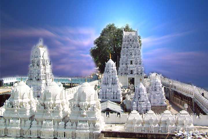
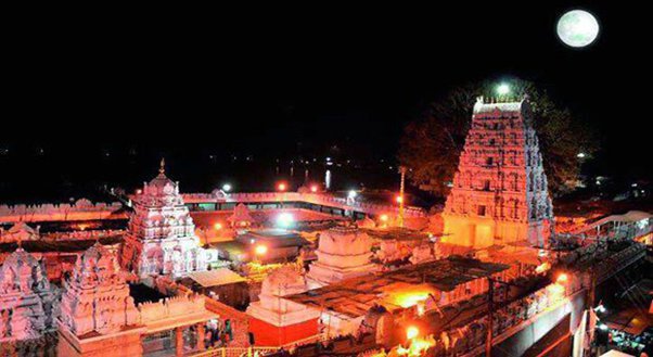
vemulawada , Karimnagar, Telangana, India
Sri Raja Rajeswara Temple is...
Sri Raja Rajeswara Temple is one of the most famous Hindu temples in Telangana, India, dedicated to Lord Shiva. It is located in the town of Vemulawada, Telangana, India.Historically the region was the capital of the Vemulawada Chalukyas who ruled from 750 to 973 CE.
The beautiful town houses the very famous temple, and the rest of it is crowded with little kiosks, shops, thousands of pilgrims and tourist vehicles! Even in the off season, the town is a scene of hectic activity with on and off tourists and if you visit Vemulawada during the Shiva Ratri or in the Karthika masam, then you have to be prepared to face heavy rush. The temple has its history deeply rooted in the era of the great Vemulawada Chalukyas. The Vemulawada Chalukyas are lesser known stem of the Chalukyas. They ruled these parts of Telangana between the 9th-10th Centuries A.D. Vemulawada was the capital of these rulers. Here Lord Shiva is in the form of Sri Raja Rajeshwara and people fondly refer to him as Rajanna. The place is also very closely associated with the 11th Century Telugu poet, Vemulawada Bheemakavi.
Source from google
The nearest Airport Rajiv Gandhi International Airport. We need to take an private vehicle the distance between Rajiv Gandhi International Airport to Sri Raja Rajeswara Temple is 194Kms
The nearest Railway station Karimnagar Railway Station. We need to take an private vehicle the distance between Karimnagar Railway Station to Sri Raja Rajeswara Temple is 37.2Kms
The nearest Bus Stand is Vemulawada Bus Station. We need to take an private vehicle the distance between Vemulawada Bus Station to Sri Raja Rajeswara Temple is 1.2Kms


Best Time To Visit: December, January, Winter, February, March, Spring, April, May, June, July, Summer, August, September, Autumn, October, November, Monsoon
Kannur, Kerala, India
The Payyambalam Beach is an...
The Payyambalam Beach is an impeccably maintained destination in Kannur. This secluded location is known for providing one with the opportunity to simply relax or enjoy a family picnic in absolute tranquillity. Surfing and swimming options are also available for those who seek a little adventure. Being close to Kannur town has made it a favourite haunt for tourists and locals alike.
Source from google
The nearest Airport Kannur international airport . We need to take an private vehicle the distance between Kannur international airport to Payyambalam Beach is 28.9kms
The nearest Railway station Kannur Railway Station. We need to take an private vehicle the distance between Kannur Railway Station to Payyambalam Beach is 2.2kms
The nearest Bus Stand Kannur Bus Stand. We need to take an private vehicle the distance between Kannur Bus Stand to Payyambalam Beach is 3.7kms

Best Time To Visit: December, January, Winter, February, March, Spring, April, May, June, July, Summer, August, September, Autumn, October, November, Monsoon
Cherai, Kerala, India
Around two dozen kilometers from...
Around two dozen kilometers from the industrial district of Ernakulam and to the side of the Vypeen Island lies every swimmer’s paradise, Cherai Beach. It is a favorite haunt of those looking for a relaxing swim with the backdrop of coconut groves being the added incentive. It provides a wonderful view of the famous Chinese Fishing Nets or Cheena Vala well. The nearby shacks provide you with fresh cuisine that fills you up perfectly after a delightful swim.
The seashells found here are unique and one often runs into dolphins in this area. It is the ideal blend of both the backwaters and the sea. The area itself has seen many new resorts and hotels crop up, which have facilitated the increase in tourist activity. Today it is amongst the most visited beaches in Kerala with a view that make it near impossible to tear yourself away once you get there.
Source from Google
The nearest Airport Cochin International Airport . We need to take an private vehicle the distance between Cochin International Airport to Cherai Beach is 25.9kms
The nearest Railway station Ernakulam Junction railway station . We need to take an private vehicle the distance between Ernakulam Junction railway station to Cherai Beach is 28.4kms
The nearest Bus Stand Ernakulam Ksrtc bus stand We need to take an private vehicle the distance between Ernakulam Ksrtc bus stand to Cherai Beach is 27.6kms
Best Time To Visit: December, January, Winter, February, March, Spring, April, May, June, July, Summer, August, September, Autumn, October, November, Monsoon
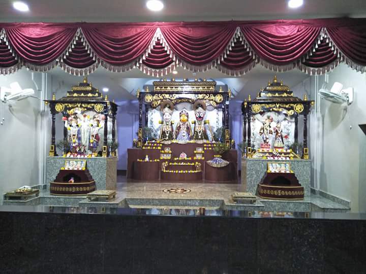
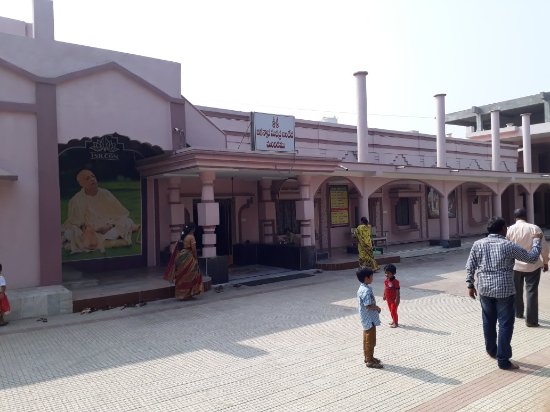
Warangal, Telangana, India
ISKCON Warangal was established to...
ISKCON Warangal was established to propagate the teachings of the Bhagwad Geeta and inculcate Krishna Consciousness within a larger population in the region. The temple complex is a well maintained place of worship that offers a tranquil atmosphere to learn and soak in the divine powers of the deity.
It is one of the must-visit places in Warangal as the temple is decorated with intricate artworks symbolising various happenings in the Hindu Mythology. The temple is setup in a surreal environment that is calm and lets one be peaceful and move in the direction of divinity.
Source from google
The nearest Airport Rajiv Gandhi International Airport. We need to take an private vehicle the distance between Rajiv Gandhi International Airport to ISKCON Temple Warangal is 184.1Kms
The nearest Railway station Warangal Railway station. We need to take an private vehicle the distance between Warangal Railway station to ISKCON Temple Warangal is 7.3kms
The nearest Bus Stand is Warangal Bus Stand. We need to take an private vehicle the distance between Warangal Bus Stand to ISKCON Temple Warangal is 7.3kms
Best Time To Visit: December, January, Winter, February, March, Spring, April, May, June, July, Summer, August, September, Autumn, October, November, Monsoon
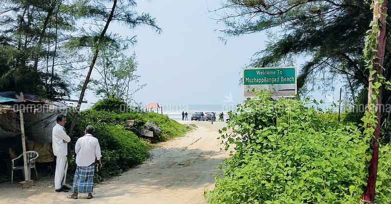
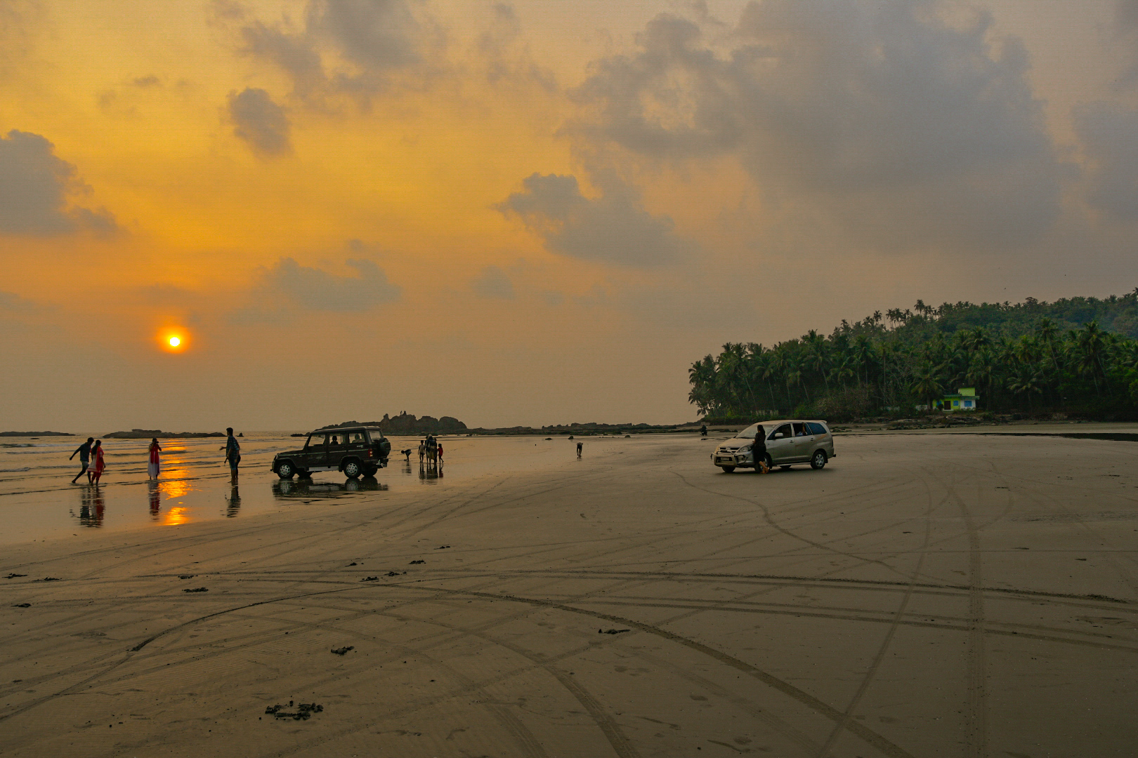
Muzhappilangad, Kannur, Kerala, India
Muzhappilangad Beach is famous for...
Muzhappilangad Beach is famous for being Kerala’s only drive-in beach. At about 7km from Thalassery in Kannur, you have a 4 km stretch of sand that awaits you to simply drive along as you soak in the view of the beautiful Malabar Coast. Along the way, one gets to munch on delicacies from a number of shacks that offer authentic Malabar cuisine. It is often considered a swimmers paradise as the black rocks protect the beach from deep currents. This is a perfect way to relax and soak in this clean and well maintained beach. One can also partake in adventure sports like paragliding, parasailing and micro light flights along with water sports, power boating or a simple catamaran ride.
Entry fee: There is no fee charged to enter the beach but if you want to drive a vehicle on the beach, you are charged INR 10.
Source from google
The nearest Airport Kannur international airport . We need to take an private vehicle the distance between Kannur international airport to Muzhappilangad Beach is 27.1kms
The nearest Railway station Kannur Railway Station. We need to take an private vehicle the distance between Kannur Railway Station to Muzhappilangad Beach is 15.1kms
The nearest Bus Stand Kannur Bus Stand. We need to take an private vehicle the distance between Kannur Bus Stand to Muzhappilangad Beach is 15.6kms
Best Time To Visit: December, January, Winter, February, March, Spring, April, May, June, July, Summer, August, September, Autumn, October, November, Monsoon
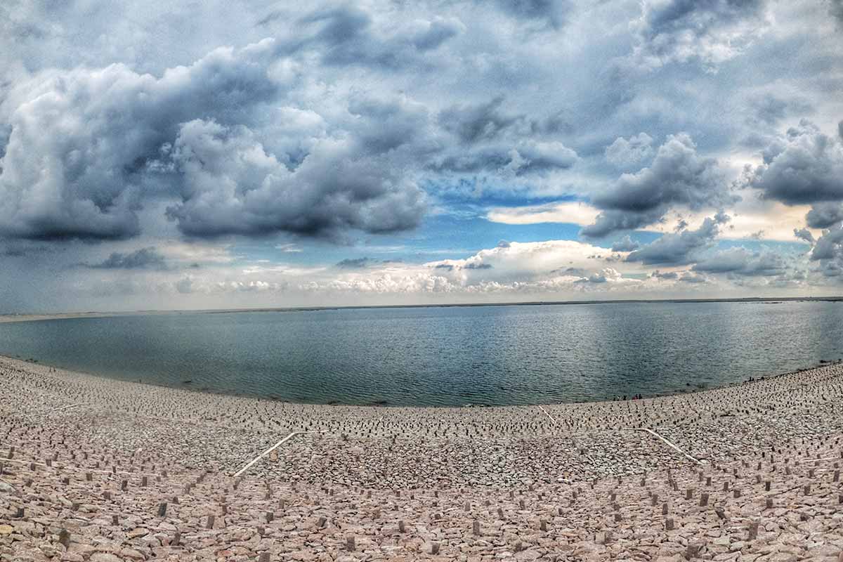
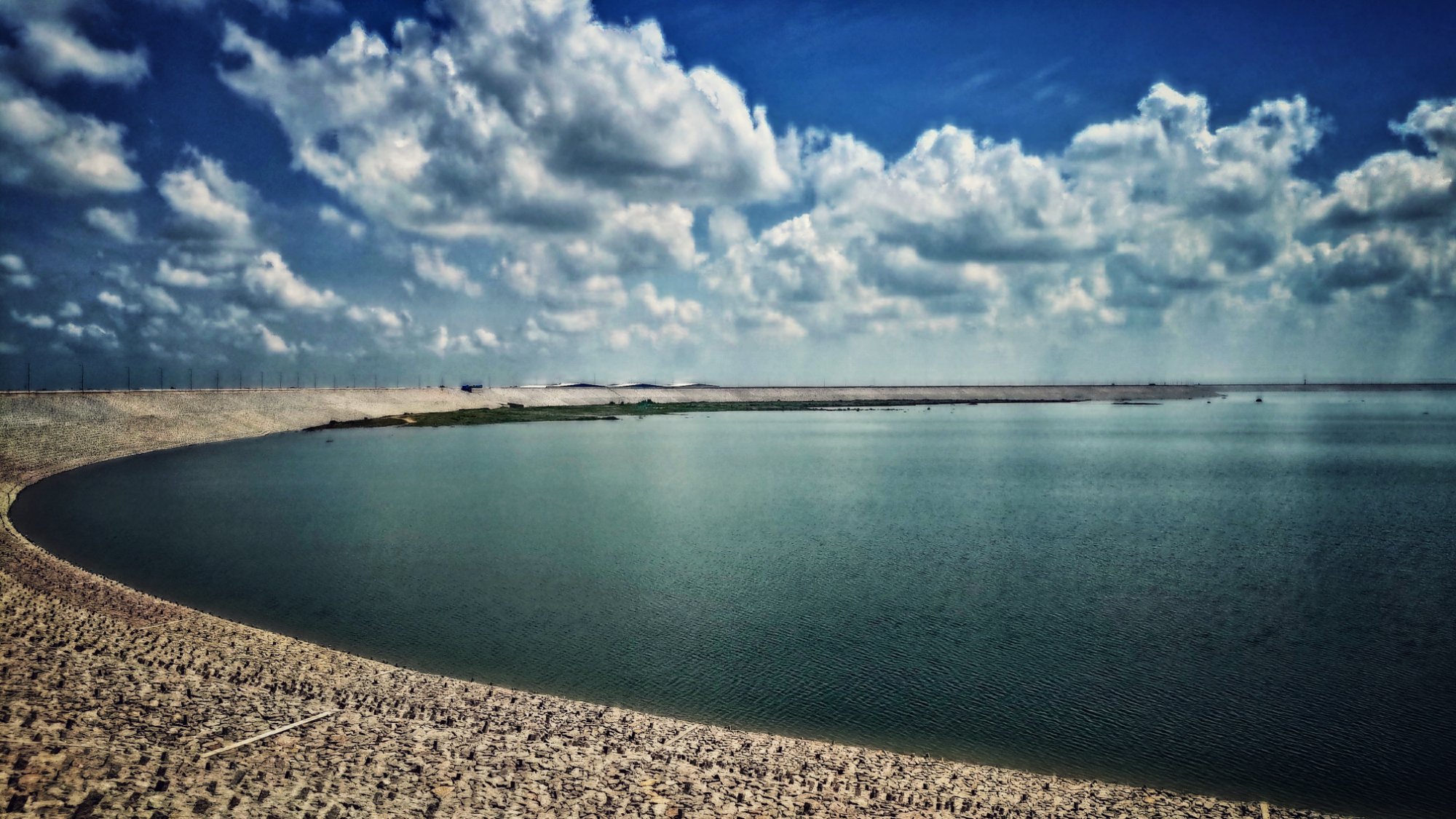
Siddipet , Telangana, India
A beautiful reservoir. A family...
A beautiful reservoir. A family picnic can be planned here. There are lot of farmhouses. One can have a good time here. It is better to go early in the morning and and get back by early evening. This is because the location is a bit remote and there is lack of lighting and other facilities. This place can be developed as a tourist spot.
This reservoir is part of Kaleswaram Project with a capacity of 15 TMC. Located at a distance of about 50 Kms from Hyderabad, which offers breathtaking views and is a perfect location for weekend getaway. Journey to the reservoir through lush green fields and scenic beauty makes the visit blissful and memorable.
Source from google
The nearest Airport Rajiv Gandhi International Airport. We need to take an private vehicle the distance between Rajiv Gandhi International Airport to Kondapochamma reservoir is 97.9Kms
The nearest Railway station Kothagudem Railway Station . We need to take an private vehicle the distance between Kothagudem Railway Station to Kondapochamma reservoir is 63.9Kms
The nearest Bus Stand is Siddipet New Bus Stand. We need to take an private vehicle the distance between Siddipet New Bus Stand to Kondapochamma reservoir is 59.3Kms


Best Time To Visit: December, January, Winter, February, March, Spring, April, May, June, July, Summer, August, September, Autumn, October, November, Monsoon
Nellore, Andhra Pradesh, India
Sri Venugopala Swami temple is...
Sri Venugopala Swami temple is a popular temple in Nellore. This temple is exactly located in Mulapet, Nellore city in Nellore District. This temple built in 1883. Here the presiding deity Sri Rukhmini Satyabhama Sametha Sri Venugopala Swami. Here the idols of Lord Venugopala Swami and his consorts are in iblack. Special Poojas performed every Friday, Saturday and Sunday.
Sri Venugopala Swamy Temple is located in Mulapet, Nellore. This is one of the famous temples in Nellore District. This Temple Was built in 18th Century.Here the devotee is blessed by the the black stone idols of Sri Venugopala Swamy and Sri Rukmini Satyabhama.
source from google
The nearest Airport Tirupati Airport. We need to take an private vehicle the distance between Tirupati Airport to Sri Venugopala Swamy Temple is 42Kms
The nearest Railway station Nellore railway station. We need to take an private vehicle the distance between Nellore railway station to Sri Venugopala Swamy Temple is 3.3kms
The nearest Bus Stand is Nellore Bus Stand. We need to take an private vehicle the distance between Nellore Bus Stand to Sri Venugopala Swamy Temple is 1.5Kms


Get in touch